M-6.2 earthquake jolts Big Island
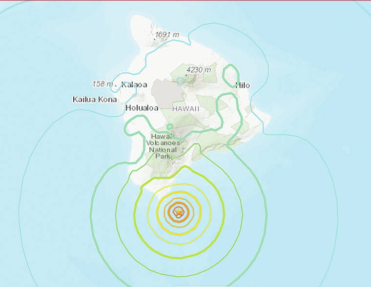
Big Island residents got a good jolt Sunday from a magnitude-6.2 earthquake that struck shortly before noon offshore of Ka‘u. However, the activity appeared to have no impact on the ongoing Kilauea eruption or Mauna Loa.
The temblor, which was recorded at 11:49 a.m. about 17 miles south-southeast of Na‘alehu, did not generate a tsunami, according to the Pacific Tsunami Warning Center. It had a registered depth of 22 miles.
A magnitude-4.3 aftershock occurred not long after, at 11:53 a.m., 3 miles north of the magnitude-6.2 earthquake, also at a depth of 22 miles, according to the U.S. Geological Survey. Two smaller aftershocks followed theses quakes. The Hawaiian Volcano Observatory cautioned that other aftershocks were possible.
Strong shaking was reported across the Big Island. Within an hour of the temblor, the USGS “Did you feel it?” service received over 1,300 felt reports. Felt reports came from as far away as Kauai.
The Associated Press reported that at a gas station in Na‘alehu, the refrigerator display doors were opened by the shaking and items fell to the ground.
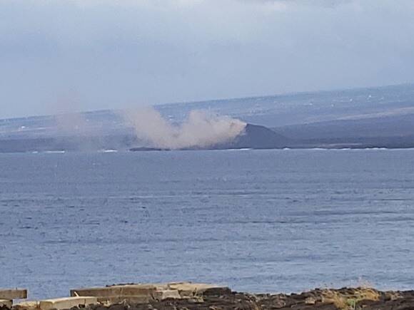
West Hawaii Today reader Aaron Caccamo was fishing at South Point when the magnitude-6.2 earthquake hit and snapped a photo of a landslide with Mauna Loa and Hawaiian Ocean View Estates in the background. Caccamo also reported slides along the cliff closer to his position.
The state Department of Transportation reported no damage at runways at Ellison Onizuka Kona International Airport, Waimea-Kohala Airport, Upolu Airport and Hilo International Airport. All flights operated as scheduled.
In addition, no damage was reported at the Big Island’s commercial harbors in Hilo and Kawaihae.
Hakalau, Kolekole, and Nanue bridges were also inspected with no damage noted.
The depth, location, and recorded seismic waves of the earthquake suggested a source due to bending of the oceanic plate from the weight of the Hawaiian Island chain, a common source for earthquakes in this area, the observatory said.
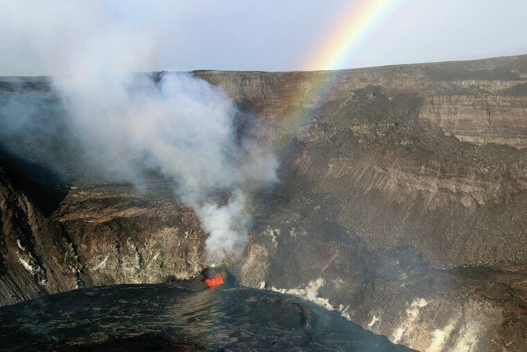
According to HVO Scientist-in-Charge Ken Hon, the earthquake had no observable impact on Mauna Loa and Kilauea volcanoes.
“Webcams and other data streams show no impact on the ongoing eruption at Kilauea except for a few minor rockfalls reported within Halema‘uma‘u crater. Please be aware that other aftershocks are possible and may be felt. HVO continues to monitor Hawaiian volcanoes for any changes. The Alert Levels/Color Codes remain at WATCH/ORANGE for Kilauea and ADVISORY/YELLOW for Mauna Loa at this time,” Hon said.
According to the observatory’s Sunday update, Kilauea volcano’s summit eruption continued with lava erupting from a single vent in the western wall of Halema‘uma‘u crater. The lake also rose another 3 feet, for a total increase of about 121 feet since the start of the current eruption Sept. 29.
The total erupted volume was estimated Sunday to be about 15.9 million cubic meters since the beginning of the eruption.
Also, no unusual activity has been noted in the Kilauea East Rift Zone, the observatory said. However, ground deformation motion Sunday continued to suggest that the upper East Rift Zone — between the summit and Pu‘u ‘O‘o — has been steadily refilling with magma over the past year.
Meanwhile, seismicity and volcanic gas emission rates remain elevated.
Sulfur dioxide (SO2) emission rates were measured at 5,300 tons per day on Friday, down from 7,000 tons per day on Wednesday, and 7,000 tons to 9,000 tons per day as of last Monday. The rate reached 85,000 tons per day at the start of the eruption.
Prior the current eruption that commenced Sept. 29, Kilauea’s most recent eruption occurred between December 2020 and May. The last major eruption occurred in 2018, destroying hundreds of homes and displacing thousands of residents. Since 1952, Kilauea has now erupted 35 times.
