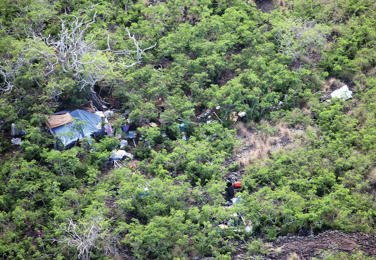
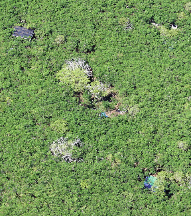
Flying in a helicopter in the skies over North Kona, Linda Thomas-Vandervoort was able to assess West Hawaii’s homeless population from a different angle
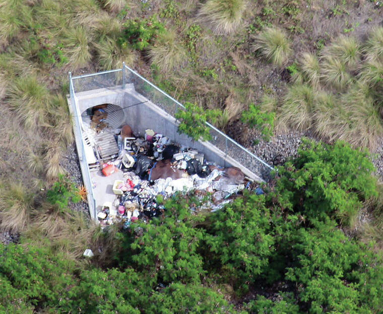
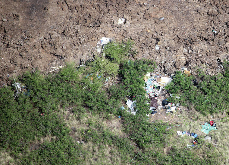
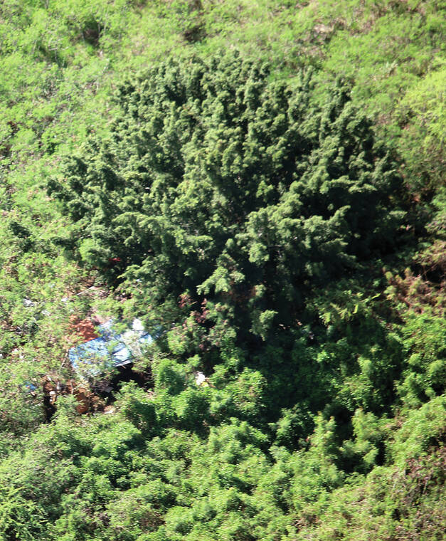
Camps, purposely hidden deep in the brush and out of sight from eyes on the ground, quickly popped out amid the landscape between Ellison Onizuka Kona International Airport at Keahole and Keauhou allowing Thomas-Vandervoort to map out a more accurate picture of the situation.
“I have thought about doing this for years,” said volunteer homeless outreach coordinator for the nonprofit West Hawaii Community Health Center. “The CEO of Paradise (Helicopters) who flew us; Calvin Dorn is just an amazing man. He was so gracious and happy to do it (free of charge). A lot of these people that I plan on making contact with, without the helicopter I wouldn’t be able to get to them.”
The flyover on Tuesday was dual-purposed: It identified the location of homeless individuals for medical outreach with the community health center as well as sites to visit during the annual Point In Time (PIT) Count to take place during that last 10 days of January on the Big Island.
The PIT, which is mandated by the federal Department of Housing and Urban Development, provides a snapshot of all those experiencing homelessness in our Shelters, streets, beaches, tents, cars, or other places not meant for human habitation. The data obtained from the single-night count is vital for receiving federal funding from HUD as well as state, local and private sources.
The flyover will help to ensure a more accurate count during the PIT, as well as help the community health center with outreach, which has become more challenging as police and private property owners have dispersed larger camps amid increased enforcement.
“Because of the constant enforcement, people are going into areas that are not easy to get to. They are going in deeper and staying in smaller groups,” Thomas-Vandervoort said. “For outreach, it just makes it harder because you have to make a lot of effort to reach a couple of people instead of being able to go somewhere and talk to 10 or more people at one time.”
That makes the maps created Tuesday critical, particularly with the community health center’s finite resources. When Thomas-Vandervoort and volunteers conduct outreach, medical providers are part of the team. Those providers also have patients to tend to at the clinics, leaving them only a couple of hours for outreach a day.
“We don’t have time to do discovery, we have to know exactly where we are going,” she said, noting that community policing will accompany her to the newly mapped sites to inform them that a medical outreach team will be coming out.
Like the medical outreach conducted by the West Hawaii Community Health Center, the Point In Time Count is not an enforcement effort, but rather a tool that is used to assist the homeless.
“I wanted to do the best I can to make sure Kona is accurately represented,” she said.
The last statewide Point In Time Count was conducted Jan. 26, 2020, when 2,010 sheltered and unsheltered individuals were identified on the Big Island, down from 2,981 in 2016.
While the 2021 count was skipped due to the ongoing coronavirus pandemic, officials confirmed to West Hawaii Today that the count go forward this year, despite the recent surging in cases.
“Our plan is to canvass secluded areas prior to the HPIT count where those who experience homelessness are unnoticed, unreachable or undocumented giving us the opportunity to engage with them during the week of HPIT,” said Carrie Ho‘opi‘i, Homeless Outreach Coordinator for Hope Services, which leads the effort for Bridging the Gap on the Big Island. “We are continuing to build trusting relationships with those we currently serve, providing them with the information on the time and purpose of this annual HPIT count.”
During the overnight count volunteers will canvass parks, beaches, parking lots, and other areas on the island that individuals or families are believed to be living. In addition to gathering demographic data, volunteers will seek information regarding current sleeping arrangements, length of homelessness and health issues, such as substance abuse and/or mental health issues.
In addition, individuals will be asked if they relocated to Hawaii in the last year, and if so from where they previously lived, why they came to the island and if they are interested in returning. One new question added this year is if the current experience of homelessness is due to COVID-19’s impact.
“The data collected provides a benchmark that can be compared county to county and year to year, which can help illustrate the effectiveness of homeless services, or explain the impact of events such as the Kilauea eruption or COVID-19,” she said.
Ho‘opi‘i wanted to send a message to those experiencing homelessness ahead of the PIT Count: “You are important. Your experience matters.
“This data will be available for all of us – you, your service providers, and your community – to use as evidence of the systemic failures that have left so many of our neighbors with no option but to live on the streets. It lets us know about racial, gender, disability, and sexual orientation inequities. It helps us make a stronger case for making housing more accessible, and providing the critical resources to help our neighbors become stabily housed and self-sufficient,” she continued.
Making housing more accessible is critical, various service providers told a Hawaii County Council committee in December during a requested update on the Big Island’s homeless situation.
“It’s out of reach. People can’t afford it and if it continues to be unattainable, there are going to be more people entering houselessness. That’s just how it is,” Kristin Alice, Hope Services Hawaii director of community relations, told the Committee on Human Services and Social Services on Dec. 7, 2021.
And the situation appears to be getting worse.
“We all know that during the pandemic real estate prices have gone up and we’ve seen a lot of out-of-state investors and speculation buying of property and pushing local residents out,” she said, explaining the current situation at her apartment complex, later adding “We got to do something to bring housing back to stop it from being pulled out of reach of the people who are going to suffer most.”
Low wages and insufficient funding for social services are also factors, she said. The average hourly wage of a renter in the county is $14.60, however, an individual would need to make $28.25 per hour to afford a two-bedroom apartment.
“The average wage is only half of what is needed for a two-bedroom apartment,” she said, noting about a third of Hawaii Island residents are renters. “A person earning minimum wage of $10.10 would need to work 112 hours per week to afford such a unit.”
Brandee Menino, CEO of Hope Services Hawaii, said during the Dec. 7 update that nonprofit placed 478 individuals in permanent housing in 2021 compared to 605 in 2020 and 715 in 2019.
The number has decreased because there just aren’t affordable rentals available, she said. Beds for those without housing are also limited on the island. According the Menino, there were just 214 emergency, 138 transitional, 151 re-entry and recovery, and 24 treatment beds available. Meanwhile, a homeless village slated for Kailua-Kona that was supposed to open in May 2021 has yet to begin construction and funding has dried up for 16 micro-units set up at the Old Kona Airport
“The challenge of finding, securing and leasing up affordable housing — and when I talk about affordable housing the majority of the folks that were helping are on fixed incomes whether they are on general assistance of $348 a month or their on social security, SSI with $794 a month. With a fair market value right now for 2021, it’s about $1,000 for a studio. Housing is not within reach for this large majority of people who are in poverty and not making enough to afford housing/ That’s the challenge in which we’re operating,” she said.
Ho‘opi‘i on Thursday said the lack of available housing persists.
“We need rental units,” she said. “The single greatest cause of homelessness is the lack of available housing at fair market value, and we are seeing a shrinking supply of homes available.”
She encouraged landlords to call their housing team lead Alison Villasista at (808) 747-1041 to find out more about renting to HOPE tenants.
“Many landlords find that by renting with HOPE, they receive more on time rental payments, while spending less time and money on their investment properties,” she said.
Individuals or groups interested in volunteering for the PIT Count should contact Joycelyn Cabal at (808) 935-3050 or email jcabal@hopeserviceshawaii.org