Mauna Loa eruption: Two of three lava fingers appear to have stalled; third remains near 10,000-foot elevation
Update at 5:15 p.m.:
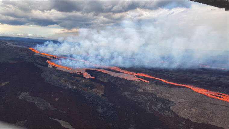
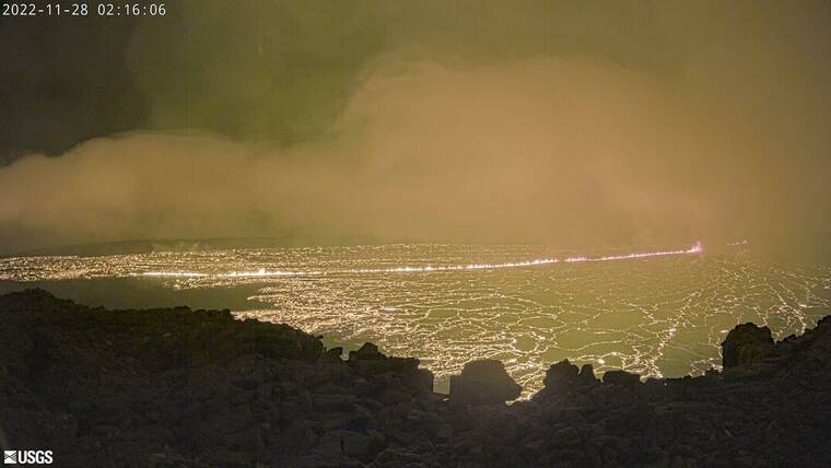
The Hawaiian Volcano Observatory reports the leading edges of two of the three fingers of lava on Mauna Loa’s northeastern flank appear to have stalled while the third remains at a high elevation — over 10,000 feet — and more than 10 miles from Daniel K. Inouye Highway.
Because the northeastern flank of the volcano is unpopulated, the lava currently does not pose a threat to any communities or infrastructure, according to Hawaii County officials.
Shelters for those who self-evacuated will remain open tonight at Kekuaokalani Gymnasium in Kailua-Kona and Robert Herkes/Ka‘u Gymnasium in Pahala.
——-
Update: The volcanic eruption that originated late Sunday within Mauna Loa’s summit caldera has shifted to the Northeast Rift Zone, prompting HVO scientists to indicate to county officials that there is no imminent threat to the community — particular, those near and around the Southwestern Rift Zone — at this time.
Those communities include but are not limited to Pahala, Naʻalehu, Ocean View, Miloliʻi, Napoʻopoʻo, Captain Cook, Kealakekua, and Keauhou — all of which are considered high-risk in the event of Mauna Loa eruption due to the steep slope of the rift zone, according to a Hawaii County media release issued shortly before noon Monday.
“Our team is on full alert and is prepared to respond to whatever situation may arise as a result of the Mauna Loa eruption,” said Mayor Mitch Roth. “That said, we’ve been told that the lava is heading in the best possible direction, which is away from our communities. We’ll continue to monitor the situation and will be providing updates to the community regularly. Until then, we thank our State and County partners, departments, and agencies for their quick action and attention to every detail.”
Officials with Hawaii County Civil Defense and the Hawaiian Volcano Observatory continue to monitor the activity, and will provide updates as the eruption changes.
Officials said it is unclear how long the eruption will last or what the volume of output will be.
“Mauna Loa is a large volcano and is capable of sizeable, long-lasting eruptions. There are not and have not been any road closures beyond the Mauna Loa Access Road, which has been closed since early this morning. Likewise, no evacuations have been called or are eminent at this time,” the press release reads.
Shelters were opened as a result of reported self-evacuations in the late evening and early morning. Those shelters are the Robert Herkes Gymnasium in Pahala and the Kekuaokalani Gymnasium in Kailua-Kona.
Meanwhile, the U.S. Army Garrison at Pohakuloa Training Area said it is also closely monitoring the eruption, including the Northeast Rift Zone area, and is in close contact with the Hawaii County Mayor’s Office, Hawaii County Civil Defense, and other agencies.
There are no troops on the ground training at PTA, and there is no immediate threat to PTA personnel, structures, or training areas. PTA will continue to work closely with Hawaii County and other agencies as the situation develops,” the U.S. Army said in a prepared release.
The Army also cautioned motorists driving on Daniel K. Inouye to drive with caution due to the number of people pulling over on the shoulders to photograph or video the eruption.
Meanwhile, Hawaii Volcanoes National Park remains open following the new eruption on Mauna Loa volcano. For safety, the park closed Mauna Loa Road from the gate at Kipukapuaulu Monday morning to vehicles. The summit, cabins and high-elevation areas of Mauna Loa have been closed since early October when the volcano began to show signs of unrest and increased seismicity. In addition, Mauna Loa Observatory Road outside of the park is also closed to the public.
“Hawaii Volcanoes National Park is keeping close watch on Mauna Loa in tandem with our colleagues at USGS and Hawaii County Civil Defense,” said Hawaii Volcanoes National Park Superintendent Rhonda Loh. “The park is currently open, but visitors should be prepared and stay informed.”
The Federal Aviation Administration has enacted a Temporary Flight Restriction encompassing a 5 nautical mile radius around Mauna Loa summit and 5,000 above ground level. Approved emergency response flights are excepted.
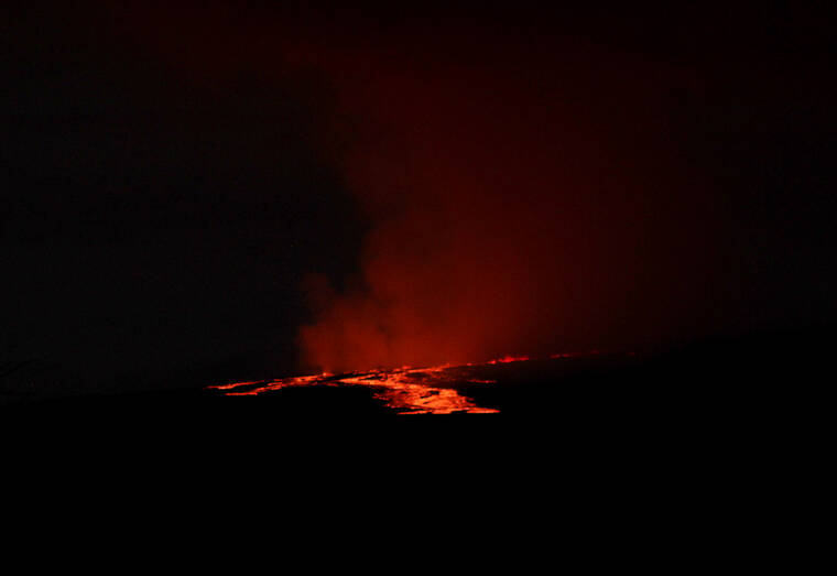
Update: Hawaii County Civil Defense confirmed at 6:30 a.m. that lava has exited the Mauna Loa summit, as reported earlier this morning by West Hawaii Today. The lava is visible on the northeastern flank of the volcano.
The area where the lava activity is not populated and the lava does not currently pose a threat to any communities at this time, Civil Defense said.
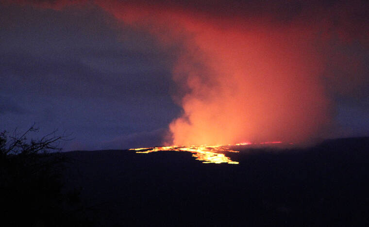
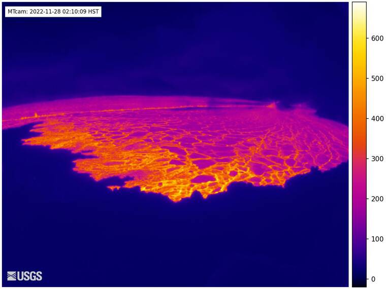
“The eruption of Mauna Loa has migrated from the summit to the Northeast Rift Zone where fissures are feeding several lava flows. HVO staff on an overflight at approximately 6:30 a.m. HST confirmed fissures at high elevations within Hawai‘i Volcanoes National Park are feeding lava flows upslope of the Mauna Loa Weather Observatory,” the Hawaiian Volcano Observatory said at 7:20 a.m.
All Hawaii Island public schools are open Monday, the Department of Education reports.
Update: It appears lava has breached the summit and is flowing down-slope in a northerly direction, a West Hawaii Today reporter said about 6 a.m. Monday. The lava flow remains close to the summit at this time.
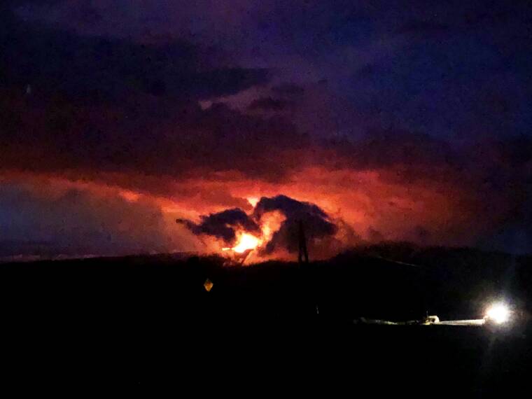
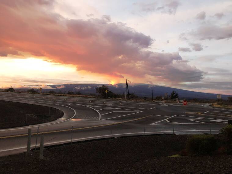
Update: An ashfall advisory is in effect for Hawaii Island following the start of an eruption in Moku‘aweoweo, the summit caldera of Mauna Loa, inside Hawaii Volcanoes National Park, late Sunday night.
A trace to less than a quarter inch of ashfall accumulation is forecast through 10 a.m. Monday, according to the National Weather Service in Honolulu. Forecasters cautioned of possible harm to crops and animals, minor equipment and infrastructure damage, and reduced visibility during the event. Widespread clean up may be necessary.
As of the U.S. Geological Survey Hawaiian Volcano Observatory’s most recent update issued at 2:43 a.m., the eruption continues with all vents remain restricted to the summit area.
“Lava flows in the summit region are visible from Kona. There is currently no indication of any migration of the eruption into a rift zone,” scientists said.
Hawaii County Civil Defense spokesman Cyrus Johnasen said the county had not been informed of any school closures.
Update: The County of Hawaii has opened shelters in Kaʻu at the Robert Herkes Gymnasium in Pahala and at the Old Kona Airport Gymnasium (Kailua Park) in Kailua-Kona amid reports of self-evacuations along the South Kona coast.
“Multiple images have surfaced on social media indicating lava activity outside of the caldera. At this time, no lava migration into a rift zone has been confirmed,” Cyrus Johnasen said in a media statement issued at 2:40 a.m. Monday.
The Hawaii Police Department has closed the Mauna Loa Access Road due to the summit eruption. The closure will be ongoing.
For more information, the community is asked to visit the County of Hawaii Civil Defense Hazard Map at http://bit.ly/3GRvCUB.
Original story:
An eruption has commenced in Moku‘aweoweo, the summit caldera of Mauna Loa, inside Hawaii Volcanoes National Park, the U.S. Geological Survey’s Hawaiian Volcano Observatory announced late Sunday night.
The eruption began at approximately 11:30 p.m., the observatory stated.
“At this time, lava flows are contained within the summit area and are not threatening downslope communities. Winds may carry volcanic gas and possibly fine ash and Pele’s hair downwind,” scientists wrote.
Residents at risk from Mauna Loa lava flows should review preparedness and refer to Hawaii County Civil Defense information for further guidance, according to HVO.
Based on past events, the early stages of a Mauna Loa eruption can be very dynamic and the location and advance of lava flows can change rapidly.
If the eruption remains in Moku‘aweoweo, lava flows will most likely be confined within the caldera walls. However, if the eruptive vents migrate outside its walls, lava flows may move rapidly downslope, scientists said.
“HVO is in close consultation with emergency management partners and will be monitoring the volcano closely to provide further updates on activity. As soon as possible, HVO will conduct aerial reconnaissance to better describe the eruption and assess hazards,” scientists said.
The volcano, which stands about 13,680 feet above sea level on the island of Hawaii, last erupted in 1984, the observatory said. Since 1843, it has erupted 33 times, with the time between eruptions ranging from months to decades, according to the observatory.
The Associated Press contributed to this report.
Update: The County of Hawaii has opened shelters in Kaʻu at the Robert Herkes Gymnasium in Pahala and at the Old Kona Airport Gymnasium (Kailua Park) in Kailua-Kona amid reports of self-evacuations along the South Kona coast.
“Multiple images have surfaced on social media indicating lava activity outside of the caldera. At this time, no lava migration into a rift zone has been confirmed,” Cyrus Johnasen said in a media statement issued at 2:40 a.m. Monday.
The Hawaii Police Department has closed the Mauna Loa Access Road due to the summit eruption. The closure will be ongoing.
For more information, the community is asked to visit the County of Hawaii Civil Defense Hazard Map at http://bit.ly/3GRvCUB.
An eruption has commenced in Moku‘aweoweo, the summit caldera of Mauna Loa, inside Hawaii Volcanoes National Park, the U.S. Geological Survey’s Hawaiian Volcano Observatory announced late Sunday night.
The eruption began at approximately 11:30 p.m., the observatory stated.
“At this time, lava flows are contained within the summit area and are not threatening downslope communities. Winds may carry volcanic gas and possibly fine ash and Pele’s hair downwind,” scientists wrote.
Residents at risk from Mauna Loa lava flows should review preparedness and refer to Hawaii County Civil Defense information for further guidance, according to HVO.
Based on past events, the early stages of a Mauna Loa eruption can be very dynamic and the location and advance of lava flows can change rapidly.
If the eruption remains in Moku‘aweoweo, lava flows will most likely be confined within the caldera walls. However, if the eruptive vents migrate outside its walls, lava flows may move rapidly downslope, scientists said.
“HVO is in close consultation with emergency management partners and will be monitoring the volcano closely to provide further updates on activity. As soon as possible, HVO will conduct aerial reconnaissance to better describe the eruption and assess hazards,” scientists said.
The volcano, which stands about 13,680 feet above sea level on the island of Hawaii, last erupted in 1984, the observatory said. That eruption came within 4 miles of the city limits of Hilo.
Since 1843, it has erupted 33 times, with the time between eruptions ranging from months to decades, according to the observatory.
All of Mauna Loa’s eruptions have commenced at the summit, with about 48 percent staying within the caldera. Outside the caldera, an estimated 24 percent occurred along the Northeast Rift Zone and 21 percent occurred along the Southwest Rift Zone, according to USGS Geologist Frank Trusdell.
Six percent — or three eruptions — have occurred from radial vents on the volcano’s north, northwestern and western flanks. In 1877, an eruption started at the summit phase, migrated to a radial vent near Kealakekua Bay resulting in reports of “floating rocks that were too hot to carry,” discolored water and sulfur gases. In 1859, an eruption on the northwest flank sent lava all the way to Kiholo Bay in just eight days.
In 1950, Mauna Loa erupted from its Southwest Rift Zone at nearly 10,000 feet, sending red hot rock down the volcano’s steep flanks, crossing Highway 11 in three places and reaching the South Kona shoreline within about three hours.
Mauna Loa’s new eruption brings the number of volcanoes actively emitting lava on the Big Island to two; Kilauea Volcano has been erupting since Sept. 29, 2021 with lava confined to the summit lava lake.
