“When will Mauna Loa erupt next?” This was the title of a Volcano Awareness Month video presentation released by the USGS Hawaiian Volcano Observatory in January. This was also the topic of discussion among HVO scientists last week following the detection of slight changes in ground deformation and seismicity at the summit of Mauna Loa.
Mauna Loa is not currently erupting. But there have been signs of elevated unrest above known background activity since July 2019, when HVO increased its Volcano Alert Level to ADVISORY and its Aviation Color Code to YELLOW.
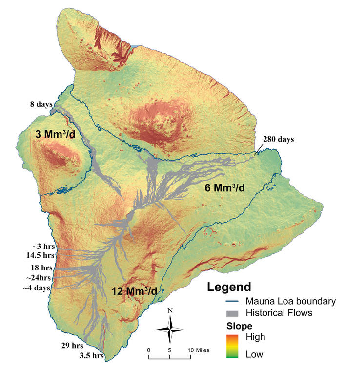
Mauna Loa is the largest active volcano on Earth, covering just over half of the Big Island. It rises gradually to 13,681 feet above sea level, and its long submarine flanks descend 3 miles below sea level to the ocean floor.
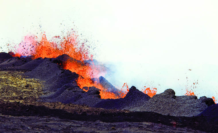
Mauna Loa, like Kilauea, has a summit caldera and two active rift zones extending from its summit. Eruptions vary from short- to long-lived, and occur at the summit, on either the Southwest or Northeast Rift Zones, or radial vents on the north and western flanks on the volcano.
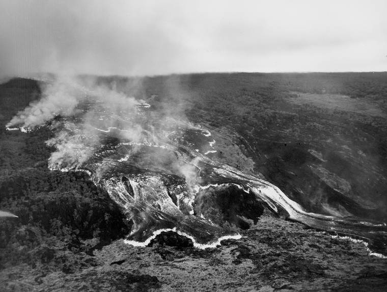
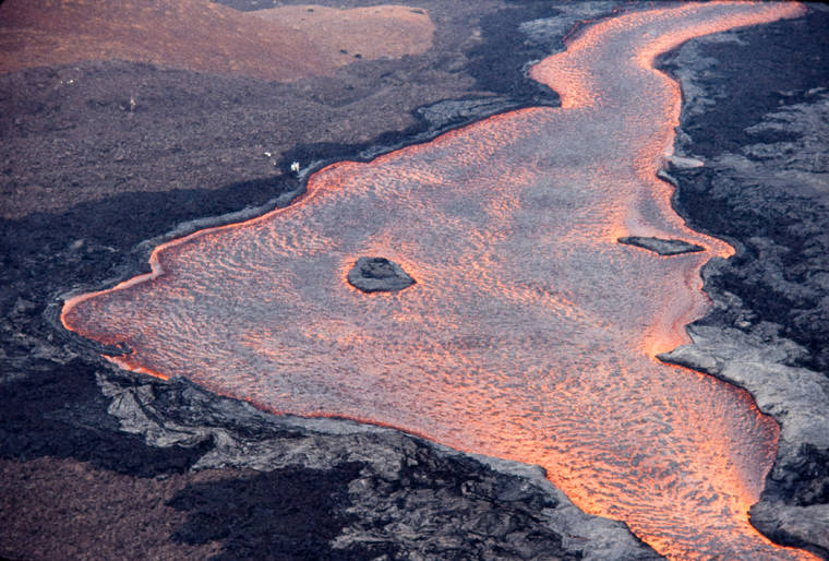
History has shown that Mauna Loa eruptions can begin with very little warning and produce high volume lava flows that travel long distances in short periods of time, impacting communities on the flanks of the volcano.
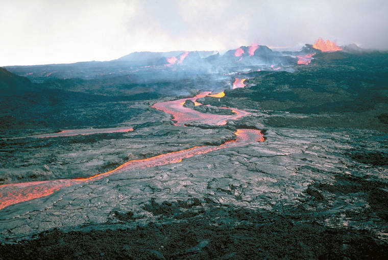
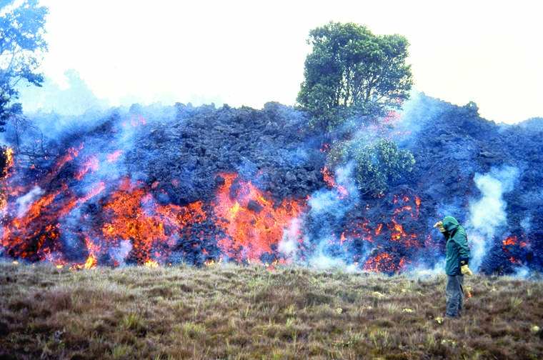
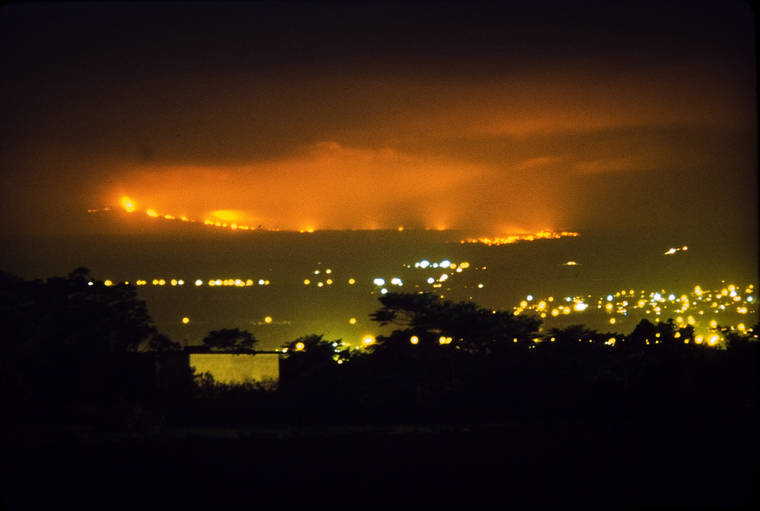
Mauna Loa’s last eruption began at its summit on March 25, 1984. A series of fissures subsequently opened along the Northeast Rift Zone, feeding lava flows that came to within 11 miles of Hilo Bay in five days. The eruption ended on April 15.
The fastest high-volume eruption from Mauna Loa in recorded history began on June 1, 1950, when fissures opened from the uppermost Southwest Rift Zone, generating a lava flow that traveled 15 miles and reached the ocean in less than three hours. Over the next 23 days, lava flows descended on both sides of the rift zone, inundating the coastal village of Ho’okena-mauka and covering the Mamalahoa Highway in three places.
HVO seismometers recorded approximately 271 small (mostly under magnitude 2), shallow (less than 4 miles deep) earthquakes last week on Mauna Loa, 226 of which were beneath the summit and upper-elevation flanks. This is a relative increase in activity, but within the range of fluctuations observed over the past several years.
HVO’s modern seismic network is capable of detecting much smaller earthquakes. But even with this greater sensitivity, recent earthquake counts are still lower than observed before past eruptions and have occurred in bursts with periods of quiet in between. We expect that shallow seismic activity will become more sustained — persistent and continuous — before an eruption.
Review of data from 1984 can help put recent observations into perspective. An immediate precursor to the 1984 eruption was an abrupt increase in the number of small earthquakes and volcanic tremor. Hundreds to over a thousand earthquakes were recorded by HVO’s seismic network each day. In the hours before the 1984 eruption, seismic activity increased to the point that the astronomical telescopes on Maunalea, 26 miles away, could not be stabilized because of the constant ground vibration.
HVO also uses remote monitoring capabilities that were not available in 1984. Telemetered GPS and tiltmeter stations record continuous ground deformation measurements that show slow, long-term summit inflation, consistent with magma supply to the volcano’s shallow storage system. A slight increase in the rate of inflation at the summit that began in January is continuing.
Current monitoring tools also include high resolution webcams, infrasound arrays, strainmeters, gas emission sensors, and access to spaceborne radar and thermal imaging measurements.
So, when will Mauna Loa erupt next? It is not possible to “predict” the exact date and time. Geophysical measurements indicate that Mauna Loa’s magma storage system has been recharging since the 1984 eruption, and there have been signs of elevated unrest since 2019, but the next Mauna Loa eruption does not appear to be imminent. Nevertheless, the recent slight increase in seismicity and ground deformation is a reminder that Mauna Loa is a “sleeping giant.”
Volcano Watch is a weekly article and activity update written by U.S. Geological Survey Hawaiian Volcano Observatory scientists and affiliates.
^
Volcano Activity Updates
Kilauea Volcano is erupting. Its USGS Volcano Alert level is at WATCH (https://www.usgs.gov/natural-hazards/volcano-hazards/about-alert-levels). Kilauea updates are issued daily.
Lava activity is confined to Halemaʻumaʻu with lava erupting from a vent on the northwest side of the crater. Field measurements as of Wednesday indicate the lava in the western (active) portion of the lake is 715 feet deep, with the eastern portion of the lava lake solidified at the surface. The summit tiltmeters show deflationary trend after the recent DI event concluded mid-day Wednedsay. Sulfur dioxide emission rates measured on Tuesday were 800 t/day. Seismicity remains stable, with elevated tremor and one minor earthquake. For the most current information on the eruption, see https://www.usgs.gov/volcanoes/kilauea/current-eruption.
Mauna Loa is not erupting and remains at Volcano Alert Level ADVISORY. This alert level does not mean that an eruption is imminent or that progression to eruption from current level of unrest is certain. Mauna Loa updates are issued weekly.
This past week, about 226 small-magnitude earthquakes were recorded beneath the upper-elevations of Mauna Loa; most of these occurred at depths of less than about 4 miles. GPS measurements show continued slow summit inflation, consistent with magma supply to the volcano’s shallow storage system. A slight increase in the rate of inflation at the summit, that began in January, is continuing. Gas concentrations and fumarole temperatures at both the summit and at Sulphur Cone on the Southwest Rift Zone remain stable. Webcams show no changes to the landscape. For more information on current monitoring of Mauna Loa Volcano, see: https://www.usgs.gov/volcanoes/mauna-loa/monitoring.
There was one event with three or more felt reports in the Hawaiian Islands during the past week: a magnitude-2.5 earthquake 18 miles north-northeast of Honokaa on Feb. 23 at 9:45 p.m.; a magnitude-3.8 earthquake 48 miles west of Kalaoa on Feb. 23 at 4:41 a.m., and a magnitude-3.0 earthquake 2 miles northwest of Pahala on Feb. 20 at 5:33 p.m.