KAILUA-KONA More than a thousand people reported feeling Monday mornings magnitude-4.9 earthquake near Laupahoehoe, according to the U.S. Geological Survey.
KAILUA-KONA — More than a thousand people reported feeling Monday morning’s magnitude-4.9 earthquake near Laupahoehoe, according to the U.S. Geological Survey.
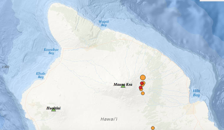
The USGS Hawaiian Volcano Observatory recorded a the temblor just before 6:36 a.m. The observatory said the earthquake’s magnitude may be refined as seismologists continue to analyze the earthquake.
The earthquake was located about 11 miles southwest of Laupahoehoe, and had a registered a depth of 20 miles.
Light to moderate shaking, with a maximum Intensity of V on the Mercalli Intensity Scale, was reported around Hawaii Island with weak shaking reported as far away as Oahu, according to the observatory. As of 9:30 a.m., the USGS “Did you feel it?” service had received over 1,300 felt reports, including 1,000 within an hour of the earthquake.
A magnitude-2.6 foreshock occurred in the same area about three minutes prior to the mainshock. Aftershocks have already been recorded; more are likely, and some could be felt, the observatory said.
The depth, location, and recorded seismic waves of the earthquake suggest a source due to bending of the oceanic plate from the weight of the volcanoes in the Hawaiian Island chain, a common source for earthquakes in this area, according to the observatory.
“HVO monitoring networks have not detected any significant changes in activity on Kilauea or Mauna Loa Volcanoes due to the earthquake,” according to HVO Scientist-in-Charge Tina Neal.
The Pacific Tsunami Warning Center said no tsunami was trigged by the earthquake. Hawaii County Civil Defense said that Department of Public Works personnel will be checking roadways in the area for rockfalls.