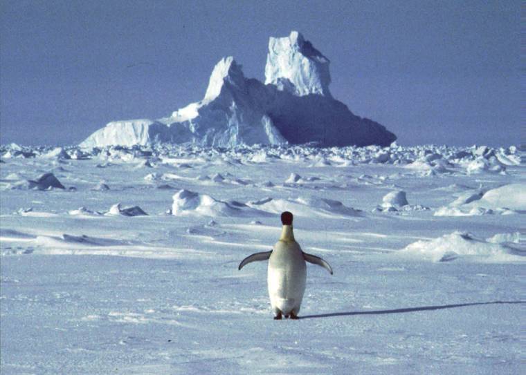
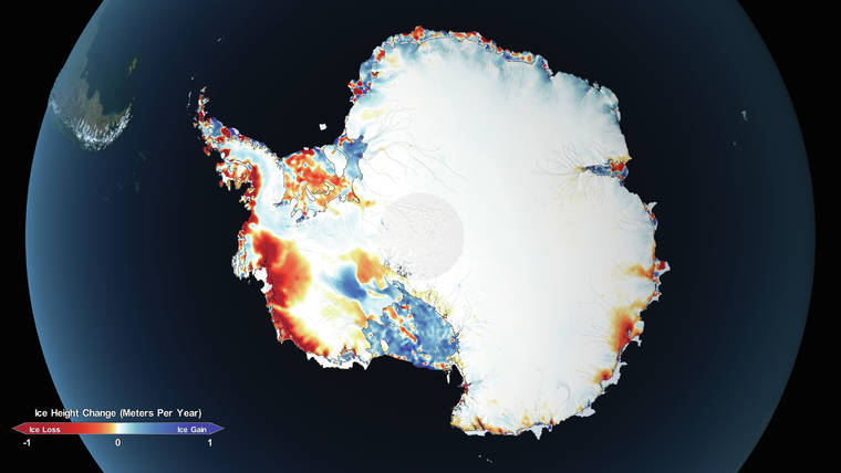
New data from space is providing the most precise picture yet of Antarctica’s ice, where it is accumulating most quickly and disappearing at the fastest rate, and how the changes could contribute to rising sea levels.
The information, in a paper published Thursday in the journal Science, will help researchers better understand the largest driver of ice loss in Antarctica, the thinning of floating ice shelves that allows more ice to flow from the interior to the ocean, and how that will contribute to rising sea levels. Researchers have known for a long time that, while the continent is losing mass overall as the climate changes, the change is uneven. It is gaining more ice in some areas, like parts of East Antarctica, and losing it quickly in others, in West Antarctica and the Antarctic Peninsula.
Helen A. Fricker, an author of the paper, said that scientists have tried to study the link between thinning shelves and what is called grounded ice, but have been hampered because most observations were of one area or the other, and made at different times.
“Now we’ve got it all on the same map, which is a really powerful thing,” said Fricker, a glaciologist at the Scripps Institution of Oceanography in San Diego.
The Ice, Cloud and land Elevation Satellite-2, or ICESat-2, was launched in 2018 as part of NASA’s Earth Observing System. It replaced a satellite that had provided data from 2003 to 2009. ICESat-2 uses a laser altimeter, which fires pulses of photons split into six beams toward the Earth’s surface 300 miles below. Of the trillions of photons in each pulse, only a handful of reflected ones are detected back at the satellite. Extremely precise measurement of these photons’ travel times provides surface elevation data that is accurate to within a few inches.
“It’s not like any instrument that we’ve had in space before,” said another of the authors, Alex S. Gardner, a glaciologist at NASA’s Jet Propulsion Laboratory in Pasadena, California. The resolution is so high that it can detect rifts and other small features of the ice surface, he said.
The researchers used the elevation measurements from both satellites to determine how Antarctica’s mass balance, the difference between accumulation and loss, changed from 2003 to 2019 for each of its 27 drainage basins. Overall, they reported the continent lost enough ice to raise sea levels by 6 millimeters, about one-quarter of an inch, during that time period.
While that finding is consistent with other studies that used data from other instruments, “in a lot of ways this is a more definitive measurement,” said Ben Smith, a glaciologist at the University of Washington and an author of the study. “It shows a set of differences that we can really understand in detail and know what they mean for the ice sheets.”
Ice loss was limited to West Antarctica and the Antarctic Peninsula; the bigger East Antarctic sheet gained mass over that time. The East Antarctic increase is likely because of increased precipitation, Gardner said. “While we can’t say that these changes are related to contemporary climate change, we can say that these are the patterns of change we expect to see in a warming world,” he said.
Increased precipitation in the form of snow leads to an increase in ice sheet mass because, as snow compresses over time, it turns to ice.
Floating ice is lost in two ways: by calving of icebergs and through melting from underneath by a deep current of warmer water that circulates around the continent.
Floating ice is, by definition, already in the water, so when it calves or melts it does not add to sea level rise. But ice shelves act as buttresses against the grounded ice behind them; when they are thin they allow that ice to flow faster. And when the previously grounded ice reaches the water, it adds to rising seas.
Scientists are increasingly concerned that the loss of floating ice in West Antarctica is causing more rapid flow of grounded ice in the West Antarctic ice sheet, and that a portion of the sheet could collapse over centuries, greatly increasing sea levels.
The study is the first to be published using data from ICESat-2, which was designed to have an operating life of at least three years. Many more studies are expected that should add to the understanding of Earth’s frozen expanses.
“Where we’re at in ice sheet science is there are still a lot of unknowns,” Gardner said. One advantage of ICESat-2, he said, is its ability to measure changes in some of the smallest ice sheet features. That will help scientists better understand how the changes are occurring and improve forecasts of future impacts as the climate continues to shift.
ICESat-2, he said, “reveals the process of change, and without understanding those processes you have no ability to make predictions.”
“It really just gives us this incredibly crisp, unified picture.”