Vog is expected to return to West Hawaii areas as northeasterly tradewinds take hold following several days of relatively clear skies.
With the tradewinds forecast to continue through at least Friday, portions of Hawaii Island, primarily the North Kona, South Kona and Ka‘u districts, may experience “intermittent concentrations” of vog from Kilauea Volcano’s ongoing summit eruption, forecasters with the University of Hawaii at Manoa’s Vog Measurement and Prediction Project said Tuesday afternoon.
Air quality could decrease to “moderate,” which is considered acceptable, however, there may be health concerns for a small number of people. The remainder of the state will experience no vog impacts, according to the project.
Though the winds are forecast to bring the vog, or volcanic smog, across West Hawaii, the amount of sulfur dioxide and other gases, which make up vog, being emitted from Kilauea Volcano continues to decrease.
The Hawaiian Volcano Observatory said Tuesday morning the volcano was pumping out 3,300 tons per day of sulfur dioxide (SO2) as of Monday afternoon. That’s down from 5,500 tons per day on Sunday, and a drastic reduction from the start of the eruption when an estimated 35,000 to 40,000 tons of SO2 was being released from Halema‘uma‘u crater.
The observatory said 3,300 to 5,500 tons per day were in the range of emission rates common for the lava lake that developed inside Halema‘uma‘u prior to the 2018 lower East Rift Zone eruption.
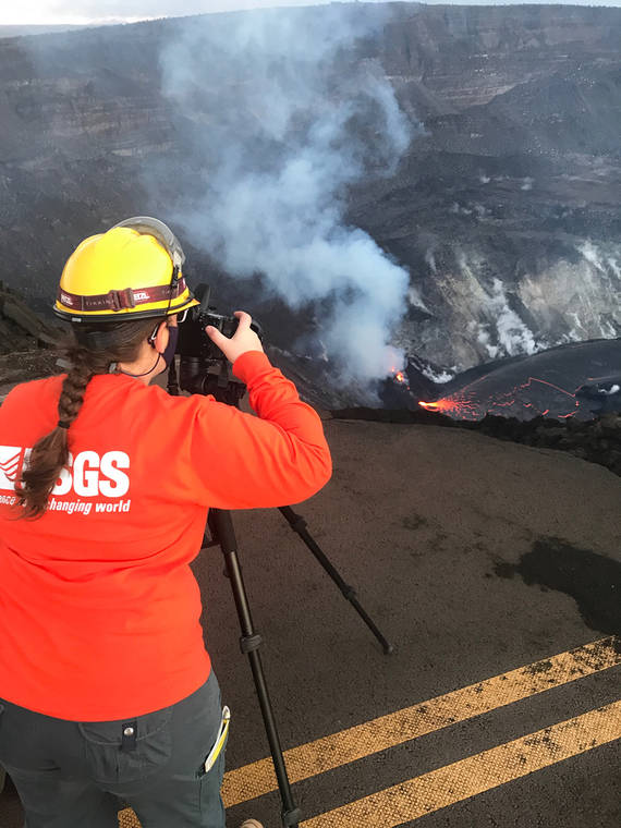
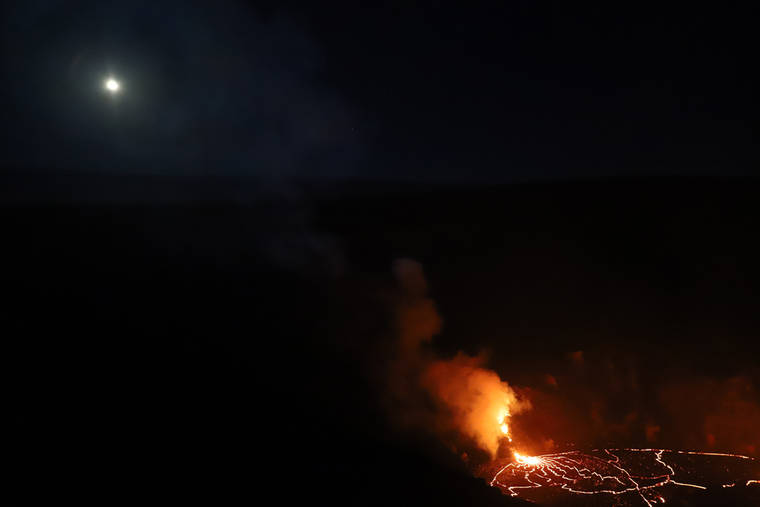
Meanwhile, lava activity remains confined to Halemaʻumaʻu on the northwest side of the crater. As of 4 a.m. Tuesday, the lava lake was estimated at 587 feet to 591 feet deep with a narrow black ledge around it, according to the observatory.
The lake’s volume was about 5 billion gallons and it covered about 72 acres. It remained was about 1,340 feet below the rim of Halema‘uma‘u.
For more information on the ongoing eruption, visit https://www.usgs.gov/observatories/hawaiian-volcano-observatory. For more information on vog, including ways to monitor air quality, visit https://vog.ivhhn.org.