Lava oozes toward highway; Ige mulls National Guard activation


As lava flows ever closer to the Daniel K. Inouye Highway, Gov. David Ige on Wednesday said he is considering activating the Hawaii National Guard.
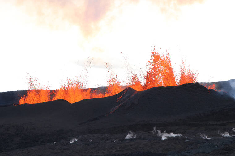
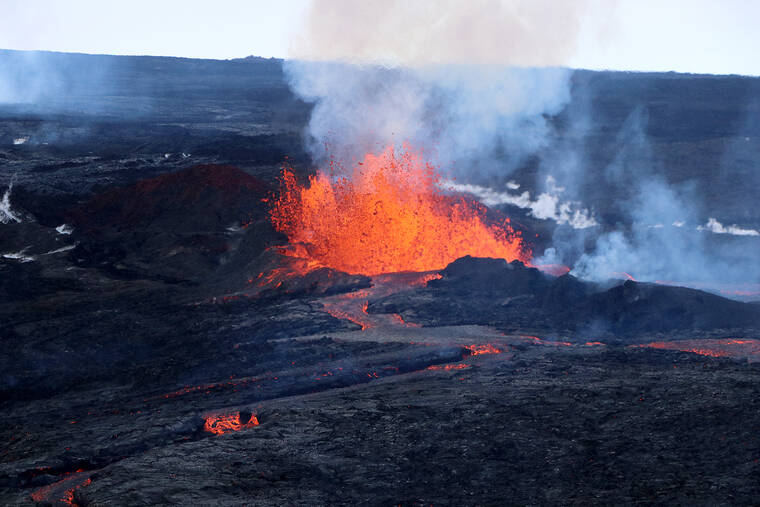
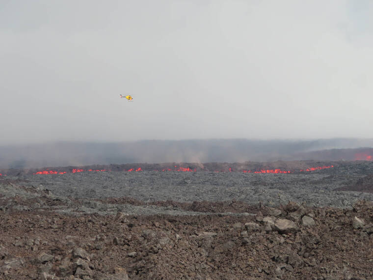
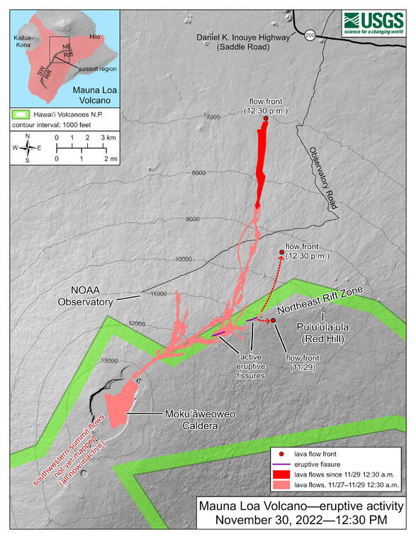
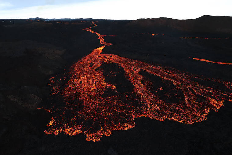
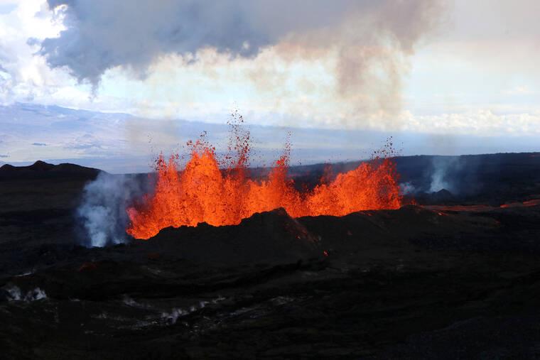
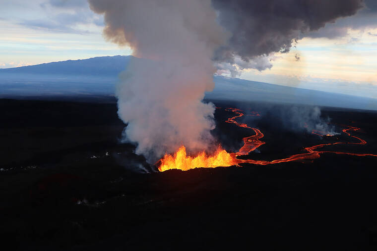
Lava from Mauna Loa volcano — which began erupting Sunday night first the first time in 38 years — was within about three miles of the highway Wednesday, and county and state authorities have been discussing contingency plans in case it is overrun.
If the highway is cut off by lava, traffic will be diverted to the Hawaii Belt Road, significantly lengthening the commute time from Hilo to Kona.
Ken Hon, scientist in charge for the U.S. Geological Survey’s Hawaiian Volcano Observatory, said the lava has begun to spread out and slow as it reached flatter land, but it remains “just a question of when” lava will cut off the highway entirely.
Although county Civil Defense Administrator Talmadge Magno said Wednesday that there have been preliminary discussions among county and state agencies for possibly diverting the lava, Hon said such a project would be challenging if not impossible.
“Imagine 10 big dump trucks of material — and that’s what we’re getting from the fissure every second,” Hon said. “So, if you think you can pile up enough material to stop that, then you’re probably wrong.”
Ige said the state will “leave no stone unturned to identify options to ensure that we don’t lose access to DKI Highway.” He also reiterated what Hon said, adding that “there is no physical way or technological way to change the course where lava flows.”
Ige didn’t specify what the National Guard would do if activated, but he said that it could assist with planning for alternative routes and making bypasses.
Ige also suggested that given the aging conditions of some of the bridges along the Hamakua Coast, some of which won’t support the weight of trucks that traverse the island via the Daniel K. Inouye Highway, ocean cargo shippers in Honolulu will have to make decisions about whether certain loads of Big Island goods should be shipped to Hilo or Kawaihae.
State Department of Transportation spokesperson Shelly Kunishige said the department will close the highway once Hawaii County Civil Defense determines it is unsafe to keep open. The DOT previously said it will close the road at the 8.8- and 21-mile markers.
Magno said Wednesday that determination will be made based on timing. He said it will take about six hours to shut down the road, so the shutdown would be ordered when the lava seems at least six hours away from the road.
Regardless of when the highway is closed, county officials urged travelers to use caution. Multiple vehicle collisions already have been reported among drivers attempting to view the lava, with one Tuesday evening crash sending two passengers to the hospital.
According to a county news release, that crash occurred at about 9:05 p.m. Tuesday, when a car that was idled on the highway’s shoulder attempted to pull back into traffic and was struck by another vehicle. Six people were involved in the crash, with two requiring medical transport for minor injuries.
The Pohakuloa Training Area’s Fire and Emergency Services reported Wednesday that it has responded to three “serious” accidents on the highway since the eruption began.
Mayor Mitch Roth reiterated Wednesday that parking alongside the highway is both dangerous and illegal, and that the Hawaii Police Department will enforce illegal parking on the shoulders between the 16- and 31-mile markers with $1,000 citations and towed vehicles.
Roth said a lava viewing area eventually will be set up for people to safely observe the eruption, but he did not specify where it would be located. However, he said Wednesday that he hopes it can open within a day.
Despite the looming threat of the lava closing the highway, the lava has caused minimal damage so far. After crossing the Mauna Loa Access Road on Tuesday morning — cutting off the access route and power to the Mauna Loa Observatory weather-monitoring station — the lava on Tuesday night also crossed the Old Kona Highway, a little-used dirt road within the Mauna Loa Forest Reserve.
Lava also breached a remote southeastern part of PTA, destroying a portion of a fence. PTA stated that, contrary to social media reports, lava has not reached the garrison itself.
Email Michael Brestovansky at mbrestovansky@hawaiitribune-herald.com.
